YOU ARE HERE: TEMPELHOF or OF FRENCH PUDDLES AND ENGLISH ISLES
Strolling Through Vanished Berlin
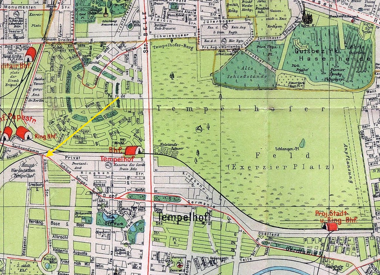
Here is part of Berlin which on one side hardly changed at all (relatively speaking, of course - we are in Berlin after all), while the other became practically unrecognisable. You are looking at the old Tempelhofer Feld and what used to be its Environs (surrounding areas) in 1921.
Before the first Flughafen Tempelhof opened in October 1923, the Feld was an expanse of open space (even more so than today), interspaced with occasional trees and even a shallow pond. The pond - here marked as Schlangen-Pfuhl (Snake Puddle), used to be called Franzosenpfuhl before. Why it was so, can only be guessed but it might or might not have something to do with Napoleon’s troops using the site as a camp.

What is certain, though, is that as this map was being drawn Columbiadamm had not been even built yet. In fact, it had not yet been planned. What for? The whole area was still nothing but nature and shooting ranges (that’s what most of the Hasenheide, now lovely public park, served as back then).
Here’s a fun fact regarding this map: the street marked in yellow - Albionstraße - was renamed “Alboinstraße” in 1931. From honouring England, or Albion, to commemorating an old Germanic ruler (in the 500s Alboin was the king of the Lombards and effectively of half of Italy). What one tiny letter-shift can do.
If you want to learn more about fascinating things about Tempelhofer Feld, do visit the Substack of Josie Le Blond - a cornucopia of information about the history of Europe’s most famous airport. A highly recommended read.
Thank you for reading Berlin Companion. If you haven’t yet, please subscribe and follow for more. Also, comment and, if a paid Annual or Founding subscriber, suggest a topic you would be interested in reading about:-)


